-
![]()
![]()
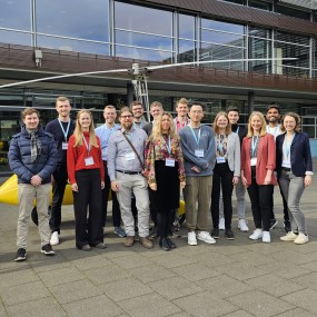
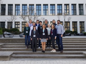
The German DGPF Conference in Remagen 2024 – motto „Stadt, Land, Fluss – Daten vernetzen“
2024/03/18
Professor Iwaszczuk travelled to Remagen together with seven employees and doctoral students from the Institute of Geodesy and six students. The TU Darmstadt team was well represented with seven posters and short presentations, two conference presentations, two posters at the Young Talent Network and a nomination for the Karl Kraus Young Talent Award.
-
![]()
![]()
Soon in Darmstadt: Ad Astra Summit
2024/03/11
Registration is now open for the As Astra Summit taking place in Darmstadt on 21 March 2024. Prof. Dorota Iwaszczuk will be active in the Press Centre.
-
![]() Picture: © Sandra Junker
Picture: © Sandra Junker![]() Picture: © Sandra Junker
Picture: © Sandra JunkerAnnouncement: Lecture by Prof. Dr.-Ing. Dorota Iwaszczuk on 21.03.2024 at the Odenwaldakademie in Erbach
2024/03/08
On 21 March, on “Forest Day”, Prof. Dr.-Ing. Dorota Iwaszczuk will give a talk on “Artificial intelligence in remote sensing for modelling forest layers: Focus on the undergrowth” at the Odenwaldakademie in Erbach's House of Energy.
-
![]()
![]()
Visit by a guest researcher from the AGH University of Krakow
2024/01/12
From January 8 to 12, Dr. inż. Antoni Rzonca visited our group as part of the 'ERASMUS+ Staff Mobility for Training' program
-
![]()
![]()
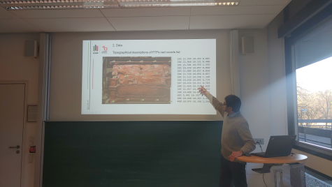
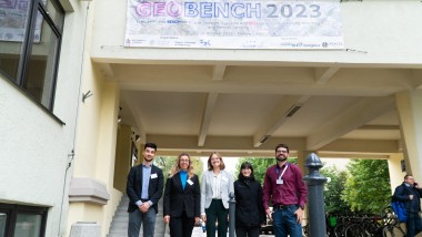
Second international GEOBENCH workshop in Krakow: the Institute of Geodesy took part
2023/11/09
Co-organised by Prof. Dorota Iwaszczuk, this year's workshop took place on 23 and 24 October 2023 in Krakow, Poland.
-
![]()
![]()
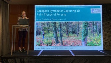
Best workshop presentation award at the Geospatial Week 2023 in Cairo, Egypt
2023/09/20
At the International Geospatial Week 2023, Mona Goebel and Prof. Dorota Iwaszczuks contribution won the prize for the best workshop presentation.
-
We are hiring!
2023/08/10
The Remote Sensing and Image Analysis group is looking for a research assistant.
-
![]() Picture: Katrin Krzepek
Picture: Katrin Krzepek![]() Picture: Katrin Krzepek
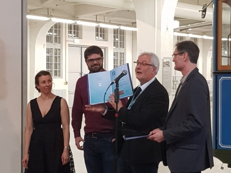
Picture: Katrin KrzepekInstitute of Geodesy wins Nico Rüpke Prize
2023/04/05
Jakob Schmidt won the Photogrammetry Award of the Nico Rüpke Foundation and the DGPF with his paper “Punkt- und ebenenbasierte Detektion von Ecken und Kanten in Innenraum-Punktwolken”.
-
![]()
![]()
DGPF in Munich – TU Darmstadt strongly represented
2023/04/05
Professor Iwaszczuk traveled to Munich together with six doctoral students of geodesy and five students. There, the TU Darmstadt team was strongly represented with three posters, three conference presentations and two presentations at the Young Scientists Network.
-
![Modell_Besprechungsraum_FlorianHorn]() Picture: Florian Horn
Picture: Florian Horn![Modell_Besprechungsraum_FlorianHorn]() Picture: Florian Horn
Picture: Florian HornQuest Editor for teachers
2023/01/23
A tool for teachers to create interactive, playful 3D learning spaces, integrated in a virtual campus, with moodle connection.
Archive