New Project: “Environment 4.0”
Use of remote sensing data for the representation and analysis of uplift and subsidence processes in Hessen
2022/02/16
Our group is working on the new project “Environment 4.0” Subproject 2: Use of digital terrain models and Copernicus data.
The project is a cooperation with the Hessian State Agency for Nature Conservation, Environment and Geology (HLNUG) (https://www.hlnug.de/) and the group “Engineering Geology” ( https://www.geo.tu-darmstadt.de/ingenieurgeologie/) of TU Darmstadt.
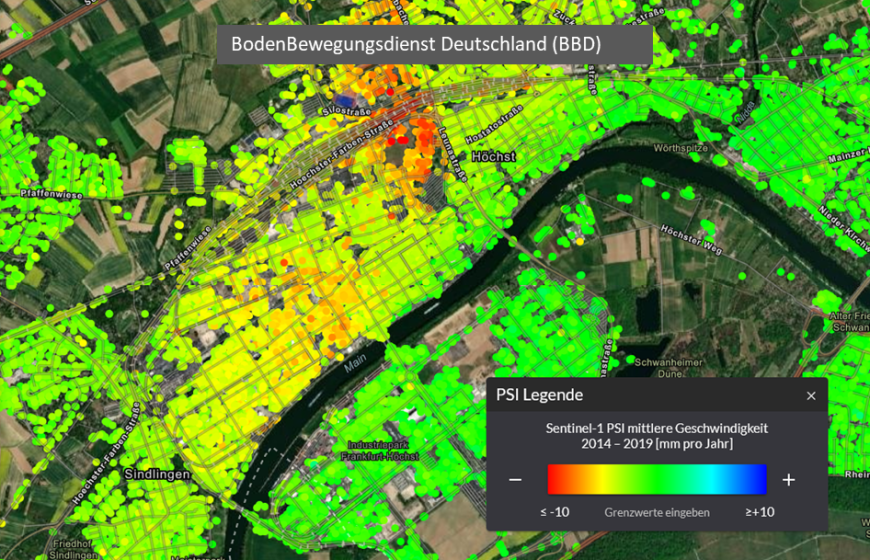
Due to falling groundwater levels and low groundwater recharge during dry periods, large-scale subsidence can occur, which can cause damage to buildings, for example. In the project, Digital Terrain Models (DTM) from laser scan data and Persistent Scatterer Interferometry (PSI) information from Copernicus data are used to represent and analyze ground subsidence and uplift processes in Hessen. The challenges in this project include the desired area representation of the PSI point information and the meaningful fusion of the different data sets. The project represents an important contribution to the digitization of geological data. The engineering geological survey of the country contributes to the defense against geohazards and is becoming increasingly important, especially in view of the changing climate conditions.