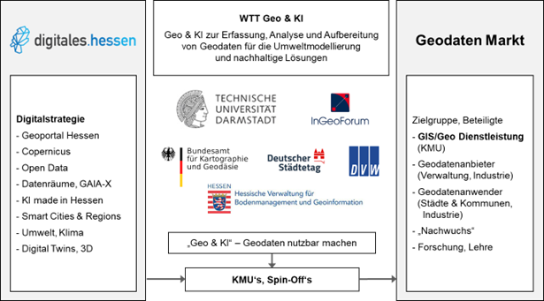
About the Project
In the WTT Geo & KI project at TU Darmstadt, interdisciplinary research collaboration between geosciences and information technology is consolidating knowledge about AI-supported acquisition (remote sensing, photogrammetry, lidar), analysis (machine learning, deep learning), and processing (mesh generation, data reduction without quality loss, digital twin) of geodata. This knowledge is being expanded in dialogue with stakeholders in the geospatial sector (geodata providers, geo/GIS service providers, and users) and then transferred to the industry through studies, publications, recommendations for action, an information center (Geo & KI Portal), and events. Business (especially KMU) and administration are involved and invited to Science Meets Business events, roundtable discussions, excursions, and demonstrations. Targeted, subject-specific start-up support measures are intended to inspire young talent for the geospatial sector and promote the establishment of startups. Overall, the aim is to demonstrate the enormous potential and diverse possible uses of geodata and to present new AI-supported technologies and methods for capturing and processing geodata for environmental modeling and sustainable solutions to the relevant stakeholders – ultimately to promote the geospatial industry.
The project is coordinated by PD Dr.-Ing. Stefan Göbel from the Serious Games Research Group at the Department of Electrical Engineering and Information Technology at TU Darmstadt and is carried out in cooperation with the Remote Sensing and Image Analysis Group (headed by Prof. Dr. Dorota Iwaszczuk) and representatives of the associated partners InGeoForum, BKG, Dt. Städtetag, DGFP, DVW, HLBG, HLNUG, and HessenForst (project advisory board).