
Sentinel-1 is the European Radar Observatory, representing the first new space component of the GMES (Global Monitoring for Environment and Security) satellite family, designed and developed by ESA and funded by the EC (European Commission). The Copernicus missions (Sentinel-1, -2, and -3) represent the EU contribution to GEOSS (Global Earth Observation System of Systems). Sentinel-1 is composed of a constellation of two satellites, Sentinel-1A and Sentinel-1B, sharing the same orbital plane with a 180° orbital phasing difference. The mission provides an independent operational capability for continuous radar mapping of the Earth with enhanced revisit frequency, coverage, timeliness and reliability for operational services and applications requiring long time series.
The goal of this project is to investigate the capability of SAR images, in this case sentinel-1 images, for fully automated classification with better spatial and temporal resolution as well as for correctness and extent comparable with existing Land Cover Maps such as CLC10, ATKIS Basic DLM and GLC-Share.
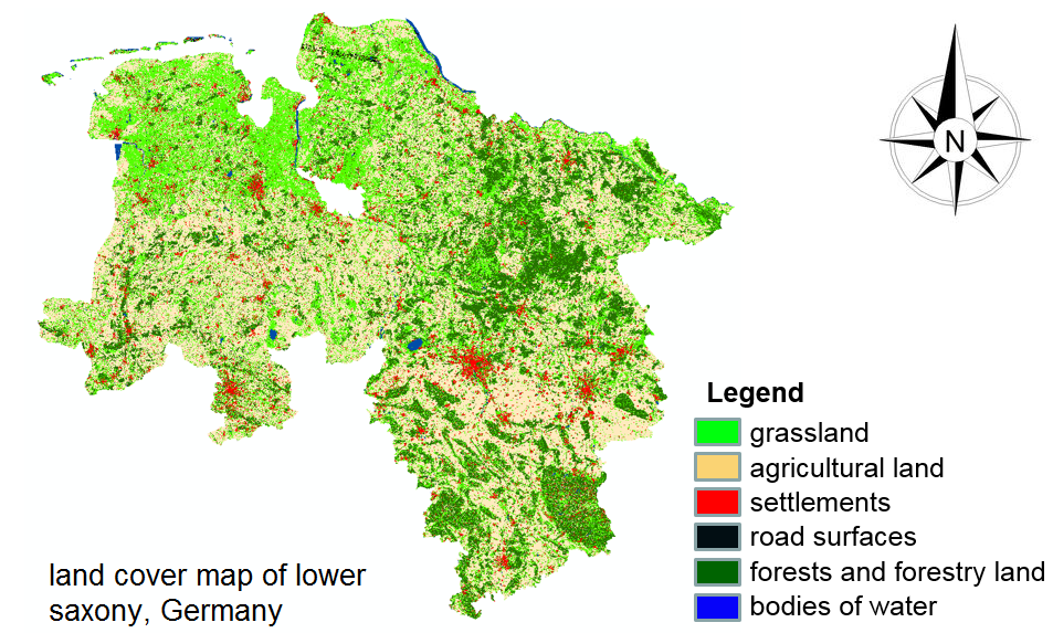
For this purpose we applied a deep learning architecture for time series classification using Sentinel-1 images. This classification contains 7 main classes:
1. grassland
2. agricultural land
3. forests and forestry land
4. bodies of water
5. road surfaces
6. settlements.