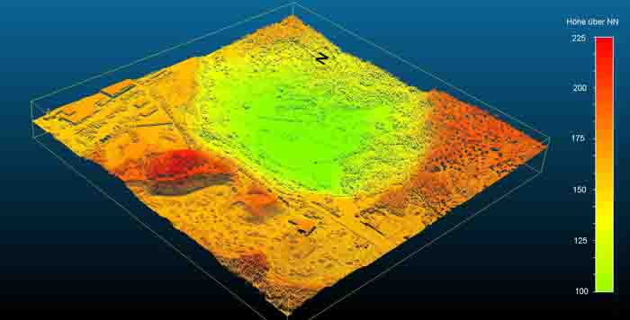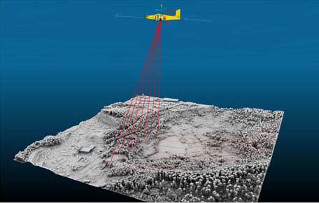
The pit was surveyed photogrammetrically and by laser scanning as part of the statewide Hesse survey. The data were kindly made available to us by the Hessian State Office for Land Management and Geoinformation Wiesbaden.
Today, with the help of computer technology, a three-dimensional virtualization of the terrain can be calculated. However, a DOM (digital surface model), an orthophoto or even a classic map can be produced just as well.