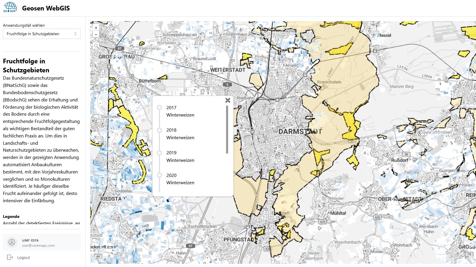
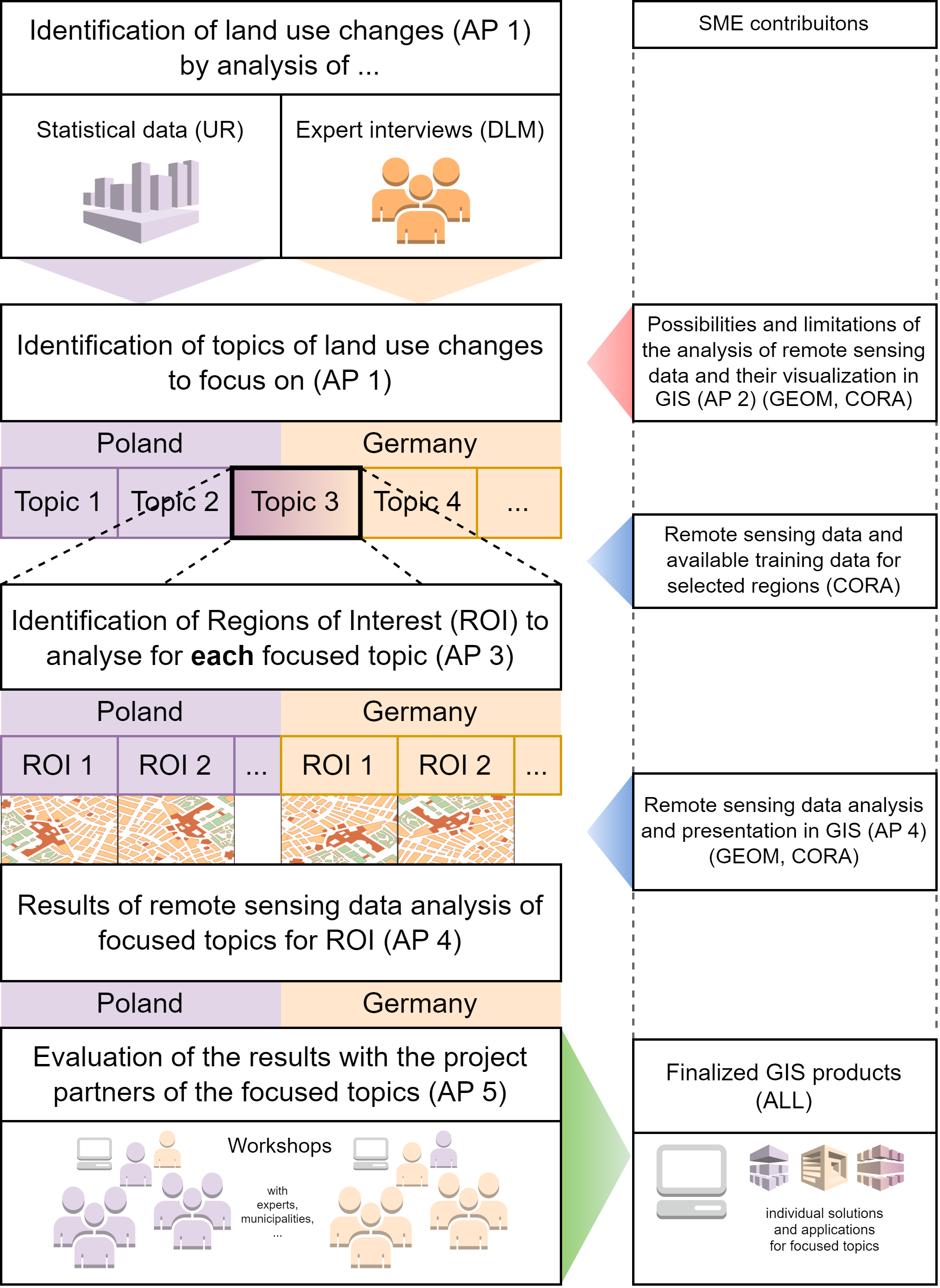
Motivation: Rural regions throughout Europe are facing similar challenges. These include strong urbanisation trends, significant shrinkage processes, increasing need for adaptation to climate change and the threat to existing cultural landscapes. In order to minimise new land use, efficient spatial development is necessary, which in turn requires a detailed and transparent data basis for managing demands and weighing them up. The planning authorities responsible for rural areas in particular lack the necessary resources for a continuous and complete collection of digital data on land use, which is in line with the concept of Smart Villages.
Objectives: Through innovative IT tools that use AI techniques to identify spatial changes in land use and can be used for development processes for the efficient and sustainable use of land as a resource and for strengthening rural areas, the secondary objective is to support development and planning processes for sustainable rural areas and smart villages for digitalisation.
| Sponsors | BMBF (FKZ 01DS22003A) |
| Partners: |
|
| Project duration: | 2022 – 2024 |
| Temporary free access to WebGIS: | https://geosen.coramaps.com |